Scientists discover deep earthquakes under Southland
New research from the University of Otago has recorded deep earthquakes buried up to 40km in Southland, uncovering evidence of hidden faults in one of the country’s least seismically active regions.
“Southland is a gap in our understanding of New Zealand’s faults, but that doesn’t mean they aren’t there and can’t cause damage,” says lead researcher Dr Jack Williams, whose work is funded by the Natural Hazards Commission Toka Tū Ake.

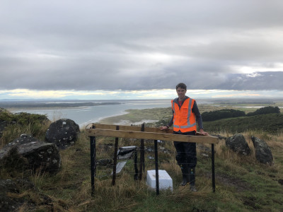
Lead researcher Dr Jack Williams with a temporary seismometer in Southland
To help fill the gap, William’s team of scientists from University of Otago and GNS Science installed 19 temporary seismometers in Southland alongside GeoNet’s sparse permanent network, and measured activity over one year. With the seismometers spaced closer together, the scientists were able to triangulate the signals to more precisely determine where the earthquakes were occurring.
“What was really striking was the depth of the earthquakes we recorded,” says Dr Williams.
Most earthquakes happen in the cold, brittle ‘continental’ crust less than 15-20km, but in Southland, Williams’ team found the seismically active continental crust extends up to twice the average depth.
“If you think of plasticene, when it’s cold and you try to tear it apart, it fractures and breaks. But if you rub it and warm it up a bit, it’s a lot more ductile. The Earth’s crust is similar. Near the surface where it’s cold, earthquakes deform the crust by fracturing and rupturing it, but the deeper down you go, the warmer it is and the more ductile the crust becomes. This makes it less likely to tear apart and flow instead.
"With this research we essentially uncovered an extra deep layer of the Earth where earthquakes can occur. This is possible in Southland because the lower part of the crust has an unusual composition with lots of iron rich minerals, which given the depth, make it relatively strong and brittle.”
As well as remarkably deep earthquakes, the seismometers picked up 85 earthquakes throughout the year – six times more than GeoNet.
“Most of these shakes were too small to feel but they give us hints about where larger earthquakes may occur in the future.”

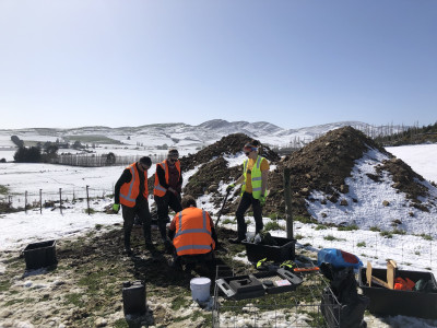
The research team installing seismometers in Southland
Williams is grateful to the landowners who granted access to their land so his team could install the seismometers. "Everyone was really happy to help, and in some cases even gave us rides to the sites. This work was only possible thanks to their support for the research.”
Williams’ team is also looking for evidence of past earthquakes using high resolution maps of Southland’s ground surface released by Environment Southland.
“These maps show us evidence of surface ruptures caused by ancient earthquakes, giving us important new information about where Southland’s fault lines are located.”
The findings can be incorporated into hazard models that predict the likelihood and strength of future earthquakes.

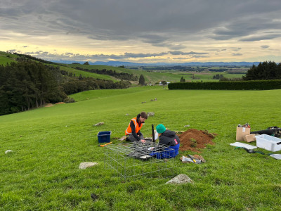
The research team installing seismometers in Southland
Dr Williams’ research is funded under an NHC University Research Programme grant led by Chair of Earthquake Science, Professor Mark Stirling, to better understand seismicity in Southland.
NHC Head of Research Dr Natalie Balfour says, “This research is part of our wider effort to better understand earthquake risk in traditionally low seismic regions. We’re also funding research into seismicity in Otago and Auckland, including how people in these regions perceive their risks.
“It’s a good reminder that earthquakes can happen anywhere, and without warning. Remember to ‘drop, cover, hold’ if you feel an earthquake, and think ‘long, strong, get gone’ if you’re in a tsunami zone. There is always something you can do to prepare your home and protect your whanau. We have quick and easy tips on our website for making your home safer for future shakes.”