Waikato seismic research may have global impact
New research into the geology of the Hamilton basin aims to create ground-breaking 3D simulations that will transform seismic modelling for the Waikato and similar sedimentary basins around the globe.
A Waikato University team, funded by EQC Toka Tū Ake, wants to better understand the depositional environments and physical properties of the sediments that have filled the basin over millions of years to more accurately predict how the ground will shake during future earthquakes.
“The Hamilton region has historically been understood as low-seismic risk, but the construction of the Waikato Expressway revealed several unknown fault lines that escalated the importance of this research,” says PhD student Dave Gardiner, one of the key researchers in the team led by Dr Andrew La Croix.
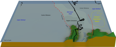
The Hamilton Basin extends about 80km from Ngāruawāhia to Te Awamutu and 50km east to west, reaching depths of around 1.6km.

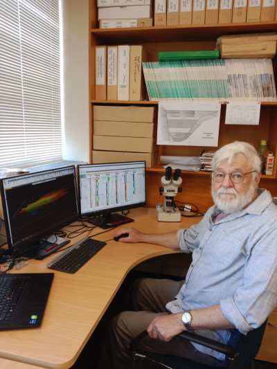
PhD student Dave Gardiner
Gardiner explains that the basin shape makes the Hamilton area susceptible to amplification of seismic waves, a phenomenon known as the ‘basin effect’.
“With a significant population and extremely important infrastructure for the country running through this area, like roads, trains, gas and transmission lines, it is important to make this area more resilient against potential earthquakes,” says Gardiner.
EQC Head of Research, Dr Natalie Balfour says that the Commission is interested in the Waikato research because it focuses squarely on making the community more resilient.
“We cannot change the natural hazards we live with in New Zealand, but at EQC we are working hard to better understand those hazards and look for ways to minimise their impact on communities and property,” says Dr Balfour.
Gardiner says that there was not much detailed geological data to work with, but regional petroleum exploration in the 1960s and 1970s had given the researchers an invaluable treasure trove of information to start computer modelling.
“Even though all those old records were paper based, we were able to use modern technology to digitally enhance this data and give us a nucleus of information from which to extrapolate a stratigraphic interpretation down to the Jurassic age basement rocks which underlie the region,” he says.

Hamilton basin
The Hamilton basin is filled with marine and terrestrial sediments deposited as layers when the Waikato region was submerged below the ocean some 36 million years ago.
More recent deposits are derived from the Taupo Volcanic Zone and distributed by a braided and shifting Waikato River before it cut down into its present position.
What makes this research internationally unique is the use of forward modelling techniques adapted from the petroleum industry.
“This will enable us to capture uncertainty in the sparse and incomplete data,” says Gardiner, who is the perfect example that you are never too old the learn.
The 71-year-old decided to do a degree in earth sciences in his mid-60s, after a career in cartography, geographic information systems, running a pottery business and a clay factory for many years.
“It’s all about well-being when you retire, so I want to keep mentally challenged as long as I can,” says Gardiner who then completed a Masters in Earth Science and was invited by Dr La Croix to work on the Hamilton Basin project as part of his PhD.